
You have no items in your shopping cart.
Frequently Asked Questions
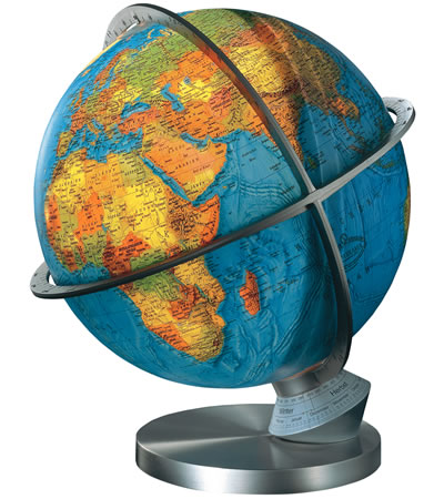
Why Buy a Globe?
Deciding to buy a globe as a gift for yourself or someone else is an excellent decision. There is really no substitute for the 3 dimensional replica of our earth. Buy a globe for anyone you know who shares your world view. Globes also make excellent anniversary and christening gifts.
"A GLOBE IN EVERY HOME"
JustGlobes presents the UK's best selection of globes. We believe that a globe is the perfect gift and that a globe given as a gift will be treasured for decades. Many of our customers have often had one themselves for 20 years or more and think that it is such an integral part of their home that their friend or relative should also have one.
BUY A GLOBE BY SIZE
Globes are measured by diameter, meaning the distance straight through the middle of the globe. Most globes are manufactured in standard sizes:
Small Globes: 9"
Medium Desk Globes: 12" and 13" (a couple of 16" models available)
Medium Floor Globes 12" and 13"
Large Globes: 16"
Extra Large Globes: 20", 25", 32" and 40"
BUY A GLOBE THAT IS ILLUMINATED OR NOT?
Illuminated globes allow a lovely, ambient light to radiate softly from the globe. A lit illuminated globe makes a beautiful night light in any room or provides mood lighting for a romantic night in.
Illuminated globe balls are made of vinyl, so that the light can show through the translucent sphere, this is usually a much better material than glass as its lower refractive index and purer transparency provides a better passage for light to pass through it. A couple of glass models are manufactured, one is called the Black Forest and the other is called the Bremen. They are made from extra thick glass to decrease fragility. They are stunning to look but are high end products that may need to be made to order.
Illuminated globes do include an electrical cord that will plug into the wall. This will dictate where you place the globe (near an outlet) and will restrict the movement or spinning action of the globe to a certain extent. All illuminated globes currently on the market are mains powered. In the near future battery powered models may become available.
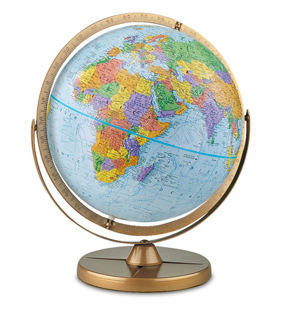
BUY A GLOBE THAT IS POLITICAL
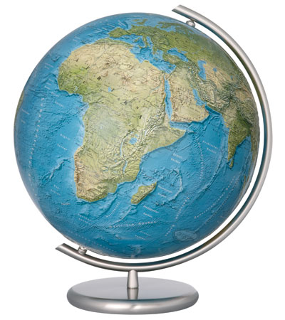
Political globes are globes that feature countries in solid blocks of color, usually with extensive labeling. Most of our globes are considered political. the advantage of political globes is that they clearly and accurately display the country boundaries. This is popular as the main reason for many people wanting a globe is so that they can clearly see where each country is, where it ends and begins. this yields secondary advantages. Political maps as described above feature countries in a multitude of different colours so that each country can be differentiated from its neighbours. This produces more vibrant and often more colourful cartography.
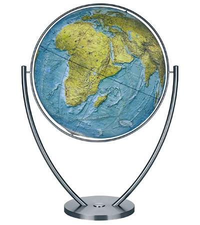
BUY A GLOBE THAT IS PHYSICAL
Physical globes use color to illustrate the natural colors of the earth. Climate conditions and landforms are shown with colouration. This greatly enhances features such as forests, deserts and mountainous regions. This is viewed by many customers as a more natural view of the Earth. Physical mapping appeals to being more interested in the Earth geographically. Non illuminated physical globes for example the Atlantis feature impressive raised relief, where ocean depths appear as grooves on the surface of the globe and mountains appear as bumps on the surface. Illuminated physical globes usually have a dual mapping feature so that when the globe is non illuminated it is physical but once illuminated all the countries light up in different colours.
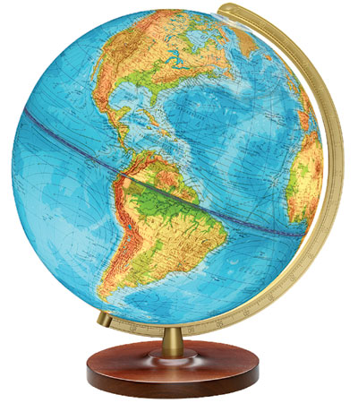
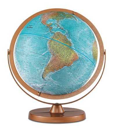
BUY A GLOBE THAT HAS A BLUE OCEAN
Most people think of the earth with oceans of blue. Of course in real life oceans only appear blue as a reflection of the sky, nonetheless this is our perception of ocean and sea colour.
We recommend blue ocean globes for kids and students predominantly as they help nurture a geographic understanding that is needed for school. In very large floorstanding globes a blue ocean also looks extremely impressive visually. Blue ocean globes are typically more educationally oriented. For example the Pioneer is an exception children's globe, with the same level of detail as an adults globe and full gyroscopic rotation, so that all parts of the globe a more easily viewed.
BUY A GLOBE THAT HAS AN ANTIQUE OCEAN
Antique oceans refer to the colour of kraft paper which results in an antique look to the globe. These globes feature current cartography and are brown in colour. Antique ocean globes are most popular for home and office décor as they integrate more easily into an environment without standing out. Antique ocean globes, especially desktop models are often more attractive as furniture pieces than blue ocean models. Antique ocean models feature the same amount of detail as a blue ocean globe but are much more oriented towards looking visually presentable than to encourage education. Antique ocean desktop globes are often slightly more expensive than blue ocean globes because of their use as furniture items. The Exeter for example is an extremely popular desktop globe. It has many advantages. The antique colour and styling make it a very attractive office or home addition, it has raised mountainous regions. The Exeter like many antique style globes features a solid hardwood base, stained a walnut colour and a champagne style, high quality metal meridian (that will never rust) as well as over 4000 place names. Globes like the Exeter make antique ocean globes the most popular at JustGlobes.
BUY A GLOBE WITH RAISED RELIEF
Raised relief globes feature texture on the globes surface to indicate the earths terrain. Mountain ranges and sometimes under sea features as well are presented in raised and indented relief. Most non illuminated globes on JustGlobes.co.uk have this often essential feature as well as some select illuminated globes. Such illuminated globes are well sought after for example the Carlyle and the Livingston.
BUY A GEMSTONE GLOBE
Gemstone Globes have become a highly prized gift item, featuring globes made entirely of gemstones. Oceans of ground Blue Lapis lazuli, Black agate, Mother of pearl and others surround continents that consist of hand-carved gemstone countries. The gemstone countries are fitted with skill and precision, creating a colourful and fascinating mosaic.
A wonderfully rich and extravagant gift for someone who means the world to you.
BUY A REPRODUCTION GLOBE
Popular for use in home or office décor, Old World Globes feature historic cartographic reproductions in a variety of sizes.
Ideal gifts for anyone interested in history.
Charming accents for any setting.
BUY AN OLD WORLD BAR GLOBE
Beautiful reproduction cartography, combined with a functional cabinet for bottles and glasses.
Great for entertaining, providing a dramatic focal point for any gathering.
BUY A GLOBE ONLINE
Choose from a wide selection of globes without leaving your home.
A globe makes an ideal gift and there's a globe for everyone at www.JustGlobes.uk
How old is my globe?
Replogle’s World Globes make wonderful collectable treasures. You may use the Historical Place Name chart shown below to determine the age of your globe. Start with the most current change and work your way back in time.
When you find a ‘former’ place name on your globe instead of the ‘new’ place name, you have confirmed the age of your globe. We invite you to share the story of your antique globe with us and other geographical enthusiasts.
| * denotes multiple listing; use caution when dating your globe. | ||
| S.S.R. = Soviet Socialist Republic | ||
| New Name |
Date
|
Former Name |
| Serbia and Montenegro |
2003
|
Serbia(pt.) |
| East Timor |
1999
|
Indonesia (pt.) |
| Congo, Dem. Repub. Of * |
1997
|
Zaire * |
| Samoa |
1997
|
Western Samoa |
| Czech. Rep. |
1993
|
Czechoslovakia (pt.) |
| Eritrea * |
1993
|
Ethiopia (pt.) |
| Slovakia |
1993
|
Czechoslovakia (pt.) |
| Serbia |
1992
|
Yugoslavia (pt.) |
| Bosnia-Herzegovina |
1992
|
Yugoslavia (pt.) |
| Croatia |
1992
|
Yugoslavia (pt.) |
| Macedonia |
1992
|
Yugoslavia (pt.) |
| Slovenia |
1992
|
Yugoslavia (pt.) |
| Armenia |
1991
|
Armenian S.S.R. |
| Azerbaijan |
1991
|
Azerbaydjzhan S.S.R. |
| Belarus |
1991
|
Byelorussian S.S.R. |
| Estonia |
1991
|
Estonian S.S.R. |
| Georgia |
1991
|
Georgian S.S.R. |
| Kazakhstan |
1991
|
Kazakh S.S.R. |
| Kyrgyzstan |
1991
|
Kirghiz S.S.R. |
| Latvia |
1991
|
Latvian S.S.R. |
| Lithuania |
1991
|
Lithuanian S.S.R. |
| Moldova |
1991
|
Moldavian S.S.R. |
| Russia |
1991
|
Russian S.S.R. |
| Tajikistan |
1991
|
Tajik S.S.R. |
| Turkmenistan |
1991
|
Turkmen S.S.R. |
| Ukraine |
1991
|
Ukrainian S.S.R. |
| Uzbekistan |
1991
|
Uzbek S.S.R. |
| Germany * |
1990
|
East Germany, West Germany unifies |
| Namibia |
1990
|
Southwest Africa (S. Afr.) |
| Yemen |
1990
|
Nth & Sth Yemen unifies |
| Marshall Islands |
1986
|
Marshall Islands (U.S.) |
| Micronesia, Federated States of |
1986
|
Micronesia, Federated States of (U.S.) |
| Nevis (See St. Kitts & Nevis) |
1983
|
|
| St .Kitts & Nevis |
1983
|
Leeward Is. (Br.) |
| Antigua and Barbuda |
1981
|
Antigua (Br.) Barbuda (Br.) |
| Barbuda (See Antigua and Barbuda) |
1981
|
|
| Belize |
1981
|
British Honduras |
| Vanuatu |
1980
|
New Hebrides Islands (Br. & Fr.) |
| Zimbabwe |
1980
|
Rhodesia |
| Grenadines (See St. Vincent) |
1979
|
|
| Kiribati |
1979
|
Gilbert Is. & Phoenix Is. (Br.) |
| Saint Lucia |
1979
|
Saint Lucia (Br.) |
| Saint Vincent & The Grenadines |
1979
|
Saint Vincent (Br.) |
| Dominica |
1978
|
Dominica (Br.) |
| Solomon Islands |
1978
|
Solomon Islands (Br.) |
| Tuvalu |
1978
|
Ellice Is. (Br.) |
| Djibouti |
1977
|
French Somaliland |
| Seychelles |
1976
|
Seychelles (Br.) Seychelle Dependencies (Br.) |
| Vietnam |
1976
|
North & South Vietnam unifies |
| Western Sahara (admin. by Morocco) |
1976
|
Rio de Oro (Spanish Sahara ) |
| Cape Verde |
1975
|
Cape Verde (Port.) |
| Comoros |
1975
|
Iles Comore (Fr.) |
| Papua New Guinea |
1975
|
Papua (Austr.) |
| Principe (See Sao Tome) |
1975
|
|
| Sao Tome & Principe |
1975
|
Sao Tome , Principe (Port.) |
| Suriname |
1975
|
Dutch Guiana |
| Grenada |
1974
|
Grenada (Br.) |
| Guinea-Bissau |
1974
|
Portuguese Guinea |
| Bahamas, The |
1973
|
Bahama Is. (Br.) |
| Bangladesh |
1972
|
India (pt.) |
| Qatar |
1971
|
Hadhramaut , Aden Br. Protectorate (pt.) |
| United Arab Emirates |
1971
|
Oman (pt.) |
| Zaire * |
1971
|
Congo, Dem. Repub. Of * |
| Fiji |
1970
|
Fiji Is. (Br.) |
| Tonga |
1970
|
Tonga Is. (Br.) |
| Equatorial Guinea |
1968
|
Fernando Po, Rio Muni (Spanish Guinea) |
| Mauritius |
1968
|
Mauritius (Br.) |
| Nauru |
1968
|
Nauru (Br.) |
| Yemen, South |
1967
|
Hadhramaut or Aden Br. Protectorate |
| Barbados |
1966
|
Barbados (Br.) |
| Botswana |
1966
|
Bechuanaland |
| Guyana |
1966
|
Br. Guyana (or Guiana) |
| Lesotho |
1966
|
Basutoland |
| Maldives |
1965
|
Maldive Islands |
| Rhodesia |
1965
|
Southern Rhodesia |
| Malawi |
1964
|
Nyasaland |
| Malta |
1964
|
Malta (Br.) |
| Tanzania |
1964
|
Tanganyika , Zanzibar unifies |
| Zambia |
1964
|
Northern Rhodesia |
| Algeria |
1962
|
French West Africa (pt.), Algeria |
| Burundi |
1962
|
Belgian Congo (pt.) , Urundi |
| Jamaica |
1962
|
Jamaica (Br.) |
| Rwanda |
1962
|
Belgian Congo (pt.), Ruanda |
| Tobago (See Trinidad & Tobago) |
1962
|
|
| Trinidad & Tobago |
1962
|
Trinidad (Br.) Tobago (Br.) |
| Western Samoa |
1962
|
Samoa Is. (N.Z.) |
| Egypt * |
1961
|
Egypt (U.A.R.) |
| Syria * |
1961
|
Syria (U.A.R.) |
| Tanganyika |
1961
|
Tanganyika Territory |
| French Equatorial Africa disolves, creating five new countries | ||
| French West Africa disolves, creating eleven new countries | ||
| Belgian Congo disolves, creating three new countries | ||
| Benin |
1960
|
French West Africa (pt.), Dahomey (pt.) |
| Burkina |
1960
|
French West Africa (pt.), Upper Volta |
| Cameroon |
1960
|
French Equatorial Africa (pt.), Cameroon |
| Central African Republic |
1960
|
French Equatorial Africa (pt.), Oubangi, Chari |
| Chad |
1960
|
French Equatorial Africa (pt.), Chad |
| Congo, Dem. Repub. Of * |
1960
|
Belgian Congo (pt.) |
| Congo, Peopleís Repub. |
1960
|
French Equatorial Africa (pt.), Gabon (pt.) |
| Cyprus |
1960
|
Cyprus (Br.) |
| Gabon |
1960
|
French Equatorial Africa (pt.), Gabon |
| Cote D'Ivoire (Ivory Coast) |
1960
|
French West Africa, Ivory Coast |
| Mali |
1960
|
French West Africa (pt.), French Sudan |
| Mauritania |
1960
|
French West Africa (pt.), Mauritania |
| Niger |
1960
|
French West Africa (pt.), Niger |
| Senegal |
1960
|
French West Africa (pt.), Senegal |
| Somalia |
1960
|
Italian, British Somaliland unifies |
| Togo |
1960
|
French West Africa (pt.), Dahomey (pt.) |
| Egypt U.A.R. (United Arab Republic) |
1958
|
Egypt * |
| Guinea |
1958
|
Fr. Guinea |
| Syria U.A.R. (United Arab Republic) |
1958
|
Syria * |
| Ghana |
1957
|
Ashanti and/or Gold Coast |
| Malaysia |
1957
|
Malay States |
| Morocco |
1956
|
French West Africa (pt.), Morocco |
| Sudan |
1956
|
Anglo-Egyptian Sudan |
| Tunisia |
1956
|
French West Africa (pt.), Tunisia |
| Vietnam, North |
1954
|
Vietnam * |
| Vietnam, South |
1954
|
Vietnam * |
| Korea, North |
1953
|
Korea |
| Korea, South |
1953
|
Korea |
| Ethiopia * |
1952
|
Ethiopia, Eritrea unifies |
| Cambodia |
1949
|
French Indo-China |
| Germany, East |
1949
|
Germany * |
| Germany, West |
1949
|
Germany * |
| Indonesia |
1949
|
Netherland Indies |
| Laos |
1949
|
French Indo-China |
| Thailand * |
1949
|
Siam * |
| Vietnam * |
1949
|
French Indo-China |
| Israel |
1948
|
Palestine (pt.) |
| Sri Lanka |
1948
|
Ceylon |
| Pakistan |
1947
|
Baluchistan |
| Jordan |
1946
|
Trans Jordan |
| Philippines |
1946
|
Philippine Islands |
| Korea |
1945
|
Chosen (Jap.) |
| Siam * |
1945
|
Thailand * |
| Eritrea * |
1941
|
Italian East Africa (pt.), Eritrea |
| Ethiopia * |
1941
|
Italian East Africa (pt.), Ethiopia |
| ithuania* |
1940
|
Lithuanian S.S.R. |
| Latvia * |
1940
|
Latvian S.S.R. |
| Estonia * |
1940
|
Estonian S.S.R. |
| Thailand * |
1939
|
Siam * |
Where can you buy a replacement light bulb for Replogle products Any hardware or lighting store should sell bulbs that will fit your globe. Some of our illuminated globes use a 25 watt candelabra light bulb and others require a standard light bulb. Please follow these guidelines for globes requiring a standard light bulb. Please do not use more than a 75watt bulb for a 32" globe, 40watt bulb for a 20" globe, and 15watts for a 12" globe.
How up-to-date is the globe?
Our vendors have a policy of updating a map every time it's printed. Although the names or boundaries of countries can change due to wars or other political upheavals, most changes are simple name changes that are relatively easy to make.
Our policy is that when the US State Department-along with the representatives (usually the Embassies of the governments involved), recognizes the changes as being a fact, we then start to implement the changes into our system.
Generally, the 9" and 12" diameter globes are the first sizes to show up in the field with the changes, followed by the 16" models and other sizes. This can be anywhere from six months to a year-depending on the field inventory.
There can be no absolute guarantee that any map is 100% current, but this should not be a deterrent to the purchase because the real value of a globe is to show true, geographical relationships.
Why a globe instead of an atlas?
Actually, an atlas complements the globe and the globe complements the atlas. Each has features that, when used together, become an excellent reference and teaching tool.
The advantage of a globe is that the world in its entirety is depicted on a sphere. As well as being functional, many globes also serve as attractive decorative accessories for homes and offices.
Using your globe
 |
Finding places on your globe
|
 |
Seeing the world on a globe
|
 |
The International Date Line
|
 |
Measuring in degrees Thousands of years ago, the Babylonians invented the system of dividing up a circle that cartographers use today. The distance around your globe, or any sphere or circle regardless of its size, is measured by dividing it into 60 sections called degrees, and each degree represents a fraction of the complete globe. |
How many different maps do we use?
Currently they use 35 different maps. This is due to the different sizes of their globes, the style types, languages, and because some customers supply their own maps to us for private label globes.
What are the globes made from?
Globes can be constructed from many materials, such as aluminum, plastic, acrylic, and Presscraft, which is a very dense and durable cardboard-like material.
How do you find a place on a globe?
Because a globe is round with no beginning or end, there are 2 imaginary reference lines from which all distances and locations are determined; these are the equator and prime meridian.
Equator: Runs East and West around the exact middle of the globe.
Prime Meridian - Imaginary line running from Pole to Pole and passing through Greenwich, England. Both the equator and the prime meridian intersect at point '0' where all numbering starts with longitude and latitude lines.
Longitude - Imaginary lines running parallel with the prime meridian through each Pole and numbered in 15º increments.
Latitude - Imaginary lines running around the globe parallel to the equator at 10º increments. Locations are uniquely identified on a globe by the point where the longitude and latitude lines intersect, i.e.
Dallas Texas is located 33º North (Latitude) 97º West (Longitude).
What's the difference between the blue and tan coloured globes?
The tanglobes are Antique in appearance and are preferred when the globe is to be used as a decorative accessory because the more neutral tan color complements almost any home or office decor.
The ocean is actually produced from a reproduction of an ancient parchment to give it the Antique or 'Old World' look. The geographic information is up-to-date and this Antiqued treatment is done primarily for its aesthetic appeal.
The blue globes, while also political, have the ocean areas in a blue (water) color and usually consist of highly contrasting, colorful, political boundaries. The youth market normally prefers such globes.
What is that little round dial at the North Pole?
It's called a Time Dial, used to compare time around the world.
Why do some globes have a metal ring or semi-ring around them?
Most globes have a metal ring either full circle or half (semi) circle. These are called MERIDIANS and they are generally numbered in degrees from 0º at the equator to 90º at either Pole.
Originally, meridians were used to help locate positions on the globe, but since globes have the longitude and latitude lines on the maps, the numbers on the meridian have become less important, but the ring itself still serves to hold the globe ball in position.
How do we choose names for our globes?
Subject to space limitations, we attempt to list all nations, all the capitals, then the biggest city in that country or state, or an important city. There are more names on the coastline because there is room for them, and we are trying to fill space as well.
We try not to abbreviate names because that would lead to confusion for our customers. If a city has some importance other than size or a capital, then it's added. The US Government has a list of names for cities and countries outside North America that they call 'conventional' names.
This is easier for us to understand than the true translation.and is why our maps show Finland, for example-rather than Suomi.
What are the bumps on some globes and why aren't they on all globes?
The 'bumps' are called raised relief and better emphasize the mountainous areas of the world. They are there so that you can see and feel the mountains-although their actual height on the globe does not have any relationship to the true relative heights of the mountain ranges.
Raised relief is found on 9", 12" and 16" diameter non-illuminated globes. On the smaller globes, it would be difficult to maintain any degree of accuracy. On a very large diameter globe, i.e., 20" & 32", the method of manufacturing doesn't lend itself to incorporating this feature.
I would like a pre-war globe showing original territorial lines
Pre-war globe such as pre-WWI, WWII, or Cold War, are considered to be "Antique Globes". These are not available through us because of the cost and difficulty associated with producing an accurate antique globe.
Why Buy A Non-Illuminated Globe?
At JustGlobes we sell all types of globes, from illuminated globes to floor standing globes. Different globes have different print quality in terms of the resolution of the countries (how accurate and fine the country borders are etc).
This page aims to explain how the paper that forms the maps of the highest quality globes lays onto the map and how this creates the superior print quality that we outline in several of our globe descriptions.
The clear difference between maps and globes is that globes are spherical whereas maps are flat. You might say "so what? Globes are simply a map rolled around a sphere". This is incorrect as seen in the picture below the map needed to cover a globe is not rectangular like a map.

In order for maps to be created in the form that they currently take (as seen on the world maps section of our website) the gaps on the image above must be filled. The act of changing the cartography from globes into maps causes slight distortion both directionally and spatially. Technology has been created to greatly minimise these negative effects but the cartography on a map will still prove to be of lower resolution than a globe.
The above text shows why we believe that globes are better in terms of cartography than maps but the same distortion problem can occur in globes.
To explain this problem we must fist explain the differences between for example, an illuminated desktop globe and non-illuminated desktop globes.
Illuminated globes have their cartography printed onto plastic which is then stretched over the globe ball. This produces the same distortion effects that plague maps. This is not always the case and any member of staff at JustGlobes can advise which illuminated globes to purchase for minimal distortion effects.
Non illuminated globes use kraft paper gores, this is the material used to make the cartography and mapping in the picture above. This is an extremely high quality material made from soft wood pulp. It is a very smooth surface compared to regular printing paper and has a much high strength. These gores are laid over the fibreboard ball in order to make the globe. This is why some lines maybe slightly out of alignment on the ball. The difference produced by this process is zero distortion of countries. In other words on a non illuminated globe what you see is what there is!
The Heirloom collection of globes at JustGlobes features illuminated globes that have had translucent paper gores layered over their balls surface. This also gives no distortion but it is a very expensive process only available on the 20" or large globe balls.
Replogle Globes

Replogle Globes have been making globes since the 1920's. Recognized as the world's leading manufacturers of world globes, Replogle World Globes has a well-earned reputation for its constant production and innovation of world globes.
From its humble beginning in a Chicago apartment, Replogle World Globes today is the world’s leader in globe production. From handcrafted masterpieces in the offices of presidents and dignitaries to classroom models that help students understand their world, their belief in the globe as a source of wonder hasn't changed.
To deliver globes to an ever broader audience. That was the vision of Luther Replogle in 1930, and this continues to be Replogle's mission to this day. Replogle World Globes believe that the appeal of a globe is deeper than its value as a learning tool or home accessory. Luther Replogle knew this from the beginning. As a school supply salesman, he took a special interest in globes, believing he could successfully market them to a broader audience.
He was right! What began with hand-assembled globes sold from a Chicago apartment (with maps sourced from England!!!!!!!!, no less) grew into what you might call a global empire, Behind the rallying cry, "A Globe in Every Home, " Replogle World Globes facilitated the globe's migration from the classroom to the living room. In 1963, Replogle co-founded Scanglobe of Denmark, going on to purchase the globe manufacturer's remaining interest in 1988 and moving its operations to the USA in 2003.
Replogle is the world's leading globe manufacturer, based in a 260,000 square foot facility near Chicago - but some things haven't changed much since 1930. Many Replogle Globes are still painstakingly hand-made by artisans who have spent the better part of their lives with the company. This is indicative of a commitment to quality, a commitment to doing things the right way, and, most importantly, a commitment to the globe itself. It is for the above reasons that Replogle World globes that are floorstanding like the Diplomat for example are simply without equal, the quality of the wooden furniture produced at Replogle World globes is a world away from all other Globe manufacturers.
It's exactly what Luther Replogle had in mind.
REPLOGLE GLOBES HISTORY
In 1930, as 122 million citizens of the United States brace themselves for what will become known as the Great Depression, experienced all over the world. From the US to Germany and the UK. Luther Replogle, along with his wife, Elizabeth, begin assembling globes in their Chicago apartment. Luther's idea -"A Globe in Every Home" flies in the face of the dwindling economy, not to mention logic itself.
Luther Replogle believed that the globe was too valuable, too beautiful to be forever relegated to classroom duty. Where he got this idea is anyone's guess. When Luther Replogle wasn't making sales calls for a school supply company, he spent his time in the Weber Costello plant, watching globe-makers at work, paying particular attention as they pasted hand-cut map gores to molded hemispheres.
Luther Replogle's interest in globes paid off. And in a constantly changing, seemingly shrinking world, his vision is more relevant today than ever. In 1930, Luther Replogle thought that a globe might help people make sense of their world. There were floods in the Mississippi River Delta, Fascism on the rise in Europe, Lindbergh attempting to fly across the Atlantic. Much was going on. The world was a big stage. It still is. Today countries in the middle east, as well as north Korea are a topic of interest in households all over the western world. Because of this globes are more popular now than ever before.
REPLOGLE GLOBES CARTOGRAPHY
The maps on all Replogle World Globes have nations, colonies, possessions, boundary lines, and place names as officially approved by the United States Government. Maintenance of the content of these maps requires frequent communication with the U.S. Department of State, the U.S. Board of Geographic Names, the Central Intelligence Agency, and the National Imagery and Mapping Agency.
In addition to these sources, Replogle World Globes communicates with embassies of other nations in Washington D.C. and foreign consulate offices in Chicago, for help with new changes in boundaries and names.
Visit Replogle Globes: www.replogleglobes.com
Thanks to Replogle Globes for providing the above information.
Why are globes tilted?
Many globes are made to tilt at an angle of 23º to match the actual tilt of the Earth. Incidentally, it is this tilting of the Earth, relative to the sun as it orbits around it, which causes the seasons to change and give us more daylight hours at certain times of the year.
George F. Cram Globes
George Franklin Cram as a company goes back to the US civil war. George himself was a veteran of the US civil war. Once he left the army in March 1867, George and his uncle founded Cram, the company. At first, the company manufactured atlas's and maps. They were, in fact, the first map and atlas publisher to use relief on maps, a type of shading that represents the height of mountains or the depth of oceans.
George Cram created the worlds most popular atlas called "unrivaled atlas of the world" which printed from the 1880's all the way until 1952.

George eventually sold his company to one of his largest customers, E.A. Peterson of the National Map Company. He later passed away in 1928 at the age of 86. In 1932 Cram, still bearing Georges name, began producing world globes like the above. In 1936, the company moved again to 730 E Washington Street in Indianapolis.
Cram specialised in educational products for schools from 1937 until 1966, becoming the first American company to sell mainly into education. It is thanks to Cram that most children in America and now in England have globes in their classrooms. In modern times Cram is still the worlds leading educational world globe supplier.
Cram globes are available all over the world, now available as floor standing models. Look out for the pale cream ocean on the globe to determine that it is a cram globe.
Frank Lloyd Wright Globes

Frank Lloyd Wright is quite simply the greatest architect in American history. He was an inspirational figure for all architects to aspire to become. He had the famous quote "every architect is - necessarily - a great poet. He must be a great original interpreter of his time, his day, his age".
He was born in Wisconsin in 1867, Frank Lloyd Wright on 8th June 1867 in Richland Centre. Frank was not just an architect, he was an educator and interior designer also. He designed more than 1000 projects in his lifetime and converted over 500 percent into completed works. This 50% success rate is simply unheard of today. In 1991 Architectural magazine published a list of the 100 most significant buildings in the world.
Frank Lloyd Wright had designed 11 of them. His legacy is something that the whole world can treasure and his title as the greatest American architect of all time was officially recognised by the American institute of Architects in 1991. In 1940 Frank himself established his own foundation in order to preserve and protect his life's work. Such is its importance in American history.

As has been mentioned before in this page, Frank Lloyd Wright did a lot more than design buildings, he also designed the interiors of his own as well as other buildings. He also designed furniture, for example the Barrel chair whose design is obvious in the above globe simply call the barrel. Frank loved to design residential properties, enjoying the challenges of meeting extremely precise and exact specifications provided by the customers.
At the time (between 1900-1917) his designs were known as "prairie houses", this is now known as a style known for its flat or low sloping roofs and horizontal lines. Such houses are also seamlessly integrated within their location and landscape creating a harmonious view. Frank Lloyd Wright also incorporated lots of Japanese ideas into his design. This helped shape his work and many believe gave him the inspiration to create work based around straight, mostly horizontal lines.
Perhaps Franks most famous design is the interior of the Guggenheim museum in New York. This took over 15 years to design and create and is a masterpiece of interior design and engineering. It is also one of the best known museums in New York city. The museum itself overlooks central park. On the inside the building rises as an off-white spiral.
The museum incorporates paintings all along the spiral towards the top of the building where an elevator can be taken to the bottom again. the most beautiful part of the museum design is that there is an open floor in the centre from which the whole spiral can be seen winding to the top of the building.

In 2009 the Frank Lloyd Wright foundation was approached by Replogle World Globes, the worlds premium globe manufacturer as Frank Lloyd Wright was passionate about fine furniture and Replogle globes are the worlds finest globe incorporated furniture. The Frank Lloyd Wright foundation unearthed many drawings from their archives including the globe seen at the top of this page.
This globe is based on a design that never went into production. Replogle used drawings, artwork and Franks buildings and interior designs to create a range of designer globes designed to be style pieces with no compromise on furniture quality. All the world globes featured in the Frank Lloyd Wright range have bases made from solid hardwood and are all officially recognised by the foundation.
These illustrious world globes start from around £200, a small price to pay for a designer furniture item.
Peter's Projection Maps
Maps can never be as accurate, or as detailed as a globe. This is because it is simply impossible to fully represent a sphere in a 2D rectangle shape. However many different techniques have been produced over the years in order to minimise spatial and directional distortion created when representing a globe on a map. This is important to map enthusiasts worldwide as it can be interesting to see the differences in country size and shape depending on the technique or "projection" used.
One very popular globe to map correctional projection is called the Peters projection. This page aims to describe the various benefits and drawbacks of this particular projection.
The Peters projection, named after Arno Peters, is one specialization of a configurable equal-area map projection. It is sometimes referred to as a cylindrical equal-area projection.
This projection achieved considerable notoriety in the late 20th century as the centrepiece of a controversy surrounding the political implications of map design. This was because the relative sizes of countries can change slightly when using a projection to represent a globe in 2D.
The Peters projection works by placing two parallel lines across the map. They must be identical distances from their nearest poles, in this case one parallel line is 45 degrees from each pole. Between these lines 36 evenly spaces circles are placed in three rows of 12. Outside of the lines 2 rows of 12 circles are evenly spaced (one for each parallel line).
A mathematical formula is used which distorts each evenly spaced circle by exactly the same amount. This distortion represents the 360 degrees of rotation around a sphere.
It is due to this even distortion that Peters himself argues makes his projection for map creation the most accurate.
Arno Peters was an amateur historian. He devised a map based on a Gall's orthographic projection in 1967 and presented it as a new invention in 1973. Some argued that this was not suitably different to the original creators in 1855 to warrant being a new invention, but the Peters project map was created nonetheless.
Peters presented his map as a superior alternative to the dominantly used Mercator projection map at the time. The Mercator projection was originally designed for navigation but was at the time used in world maps.
The weakness of the Mercator project is that is that it increasingly inflates the size of countries as the distance from the equator increases. This leads Greenland to appear as the size of Africa when in reality Africa is 14 times larger.
Since much of the technologically undeveloped world lies on or around the equator, they appear smaller and therefore less significant on a Mercator map.
By contrast to this the Peters projection map shows areas of equal size on a globe as equally sized on a map. Restoring less powerful countries to their correct proportions. This reasoning has been picked up by many educational institutions and similarly concerned groups.
The downside of the Peters projection map is that to many it looks different and unfamiliar leading people to believe that it is less accurate than it actually is. Also it suffers from extreme distortion at the polar regions making it useless for all those interested in the coldest places on earth.
Gemstone Globe Materials
At JustGlobes we strive to offer the highest quality and most detail ranges of Gemstone globes. Our gemstone globes are made using around 30 semi precious stones, some of which are described here.
Malachite
Malachite is a copper carbonate mineral, which essentially means that it is composed of Copper, Carbon, Oxygen and Hydrogen.
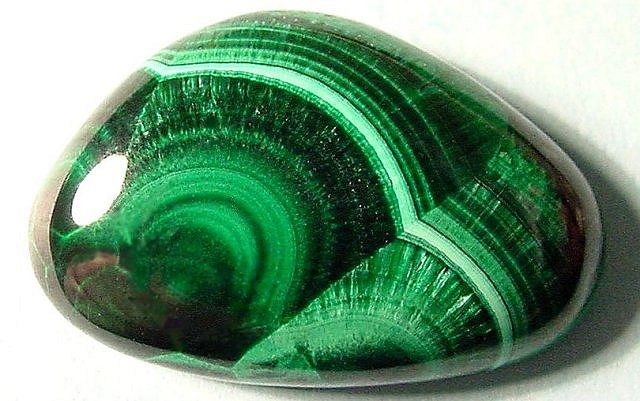
The name Malachite is derived from Greek which roughly translates to "mallow-green stone". This name given to the stone as the colour resembles that of the Mallow plant.
Malachite was used as an expensive paint pigment up to about 1800. Malachite is a good pigment as it very lightfast, meaning it doesn't fade with time or exposure to the sun as much as the majority of other minerals. This is an excellent trait for gemstone globes as materials that can resist fading over time will make for a brighter, more colourful gemstone globe for longer.
Malachite has a downside as a pigment and that is that it varies in colour noticeably depending on Oxygen concentration, this obviously produced inconsistent colour. For globes however, this is not a problem as each gemstone world globe is handmade, they are all unique and ever so slightly different. Colour variations in the semi precious occur in our gemstone world globes regularly due to changes in supply location, we feel this adds to the exclusivity and charm of the globes.
Recent historical evidence suggests that Malachite has been mined for around 300 years.
Mother Of Pearl
is an organic-inorganic composite material produced by some molluscs as an inner shell layer, it also is the material that makes up pearls. It is extremely strong and resilient making it a great globe material.

Oyster shells are used in the mother of pearl gemstone world globes at JustGlobes. They are both readily available and have a large and relatively flat inner shell layer making them the idea source for the mother of pearl globes.
When mother of pearl is broken down into individual components it is actually formed from calcium carbonate similar to chalk, a common material used to write on black boards. This may seem unflattering to what is an expensive and precious material, but the way that mother of pearl is formed tells a better story of how mother of pearl has come to be considered a precious material.
Tiny layers of calcium carbonate smaller and thinner that the eye can see and layered on top and side by side each other. These are jointed together by a matrix of organic material formed by the mollusc (in our case Oyster) itself. A good way to imagine mother of pearl is to think of the tiles that one might see in a bathroom in layers, one of top of another. This is a very simple yet beautifully organised pattern that creates the shimmer effect that makes mother of pearl so appealing.
Jasper
Jasper is a form of silica and can have a variety of different colours; red, yellow, brown, green and even blue.
 |
Jasper breaks with a smooth surface, this is an excellent ornamental quality hence Jasper is a widely used material in gemstone products. As can be seen in the picture above Jasper is a very deep and beautiful material, perfect for globes. It can also be highly polished to increase its visual effect. |
A Cartographic History of Globes
Globe History
The oldest known western terrestrial globe (a globe featuring the planets surface) was made in 1492 by a German from Nuremberg called Martin Behaim.
The most interesting thing to note about the first ever world globe was that it features gaps, where we had not yet mapped. The most significant area that springs to mind is the area west of the UK across the Atlantic ocean.
In the very same year, explorer Christopher Columbus set sail west from Spain sailing towards what he thought would be the east Indies but what turned out to be north America. This land corresponded remarkably to a large gap on Benhaim's world globe. Due to the monumental discovery of north America, the invention of a world globe seemed rather insignificant. This is completely understandable as the discovery of North America in 1492 can only be compare to the moon landings in 1969 for global impact.
Globes are among the most ancient scientific instruments known. Their history extends more than a thousand years, and today they are more popular than ever due to the communication age that we live in. One very significant contribution to the globe came from an Alexandrian astronomer and geographer called Claudius Ptolemaeus (or Ptolemy) in the second century AD. In his most noted works "the Almagest and the Geography", he recorded the earliest known description for calculating the fixed position of an object on a sphere using spherical coordinates. Such coordinate systems are the foundation on which all later globes have been designed.
The word "globe" is derived from the Latin "globus", which means sphere. Throughout the centuries globes have often been sold in pairs, one celestial or night sky and the other terrestrial or worlds surface. This became less popular toward the end of the 19th century. Celestial or night sky globes are still available today at www.JustGlobes.co.uk.
Terrestrial Globes
A terrestrial globe is easiest to conceive as a model of the Earth, it has been viewed for centuries as a symbol of open-mindedness by the scientific community as only a world globe shows each and every country in their correct proportions and all the distances between countries to the same scale. This creates no political or relative power bias that some maps display.
Celestial Globes
A celestial or night sky globe is a little more difficult to explain. The ancient Greeks perceived the Earth, moon and solar system as if it was surrounded by a hollow shell or "outer sky" of stars and various constellations, they had of course not discovered any relevant distances of stars. A celestial globe is a model of this outer sky. however because this model is seen from the Earth and therefore an inside point, the representation on the globe reversed, because we view it from an outside point.
A symbol of knowledge but also of power, the celestial globe became an attribute of Roman Emperors, emblematic of their dominion over an empire that spanned a significant proportion of the globe.
After Ptolemy and the Roman empire celestial globes became lost to the world, only the techniques behind them were remembered and passed on by Byzantine scribes. This was also threatened by Christianity which likened astronomy and astrology to paganism. It was eventually Arab scholars who revived astronomy, passed on through Islamic conquests.
The Printed Globe
Techniques like wood cutting to fashion objects and art out of wood and various metal engraving became increasing used toward the end of the 15th century in Europe. Thus early European globes were made from wood or metal.
Wooden world globes had linen or vellum laid over them on which the appropriate cartography was printed. When metal globes were used the cartography was engraved onto the surface.
The above traditional methods of globe manufacture were soon replaced by the printed globe.
It was in 1527 that the first paper gores were printed. This relates to the technique that is used today to create the highest quality globes. The cartography for the globe is printed onto convex paper segment and then laid on to the sphere as if replacing the peel of orange. This is the only method that creates no spatial or directional distortion and it is why globes are a superior reference tool when looking at the world as a whole.
Reference texts:
Globi Neerlandici by P.v.d Krogt
Globes from the Western World by E.Dekker and P.v.d Krogt.
Defining Features, Functionality & Composition of World Globes
At JustGlobes we are always trying to help our customers decide which globe will suit them best. We are positive that there is a globe for everyone.
Below are a number of important features along with an example of the feature on a globe available from us either by special order or directly from our site.
Crystal/ Glass World Globes
There are two globe models on JustGlobes that fit into this category. The Black Forest (shown) and the Bremen floorstanding globe. These globes are hand-blown like traditional glass but are made using glass-polymer. This is much stronger and more durable than traditional glass yet has a very similar refractive index making it the idea ultra-premium material for the manufacture of world globes.
Both models mentioned above are manufactured in Germany to the highest quality standards as one would expect from German manufacturing. World globes manufactured in this way are designed to appeal to the contemporary home or office. Due to the fact that they are hand blown they are only available in 16". This makes the Black Forest an impressive desktop model as the standard size for a desktop world globe 12".
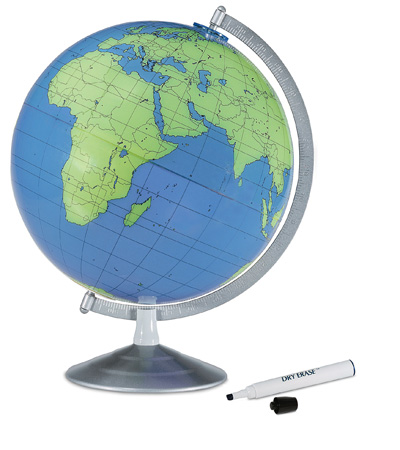
Dry Erase World Globes
There are two models available that can be written on without damaging the cartography. These are Geographer (shown) which is available directly from the website and the Blank Globe which is available if requested. These world globes are defined by their unique design function. The surface on these world globes is similar to that of a white board that you might see in a school or university.
White board pens (supplied) can be used to annotate the surface as required and can simply be wiped off when dry. Such globes are very popular among schools and other educational environments.
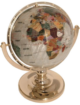
Gemstone Globes
Gemstone world globes are defined by the material that they are made out of.
Because of their superior beauty gemstone world globes are largely used solely for decorative purposes.
A gemstone globe makes a great gift for that special person who is oh so hard to buy for.
Due to the wide variety of styles and colour schemes available gemstone globes are well suited to home and office decorating.
Gemstone globes use many different types of materials, depending on the coloration that is desired for the finished globe.
In addition to Abalone Shell and Mother of Pearl, the semi-precious stones include Amethyst, Aphrizite, Belioculas Onyx, Black Spotted Jade, Chrysolithos, Coral, Green Jade, Green Jasper, Lapis, Lapis Siphnos, Mongolian Jade, Mongolian Red Spotted Jade, Mongolian White Jade, Phoenix Jade, Picture Jasper, Purple Quartz, Red Jade, Red Spotted Jade, South African Jade, Spotted Jade, Tiger Eye, Turquoise, and White Jade.
Illuminated Globes
Illuminated globes are defined by their functionality.
Thin acrylic or vinyl is normally used to make up the globe ball of an illuminated globe. This is because these materials are thinner, stronger and far less expensive than glass.
Illuminated world globes make great night lights, and are great for mood lighting.
Illuminated globes have a subtle, understated illumination that adds a warm, more person touch to a room that is difficult to achieve with standard lighting.
Models such as the Dresden (shown) are extremely popular due to the incredibly vibrant cartography achievable on an illuminated globe.
All illuminated models available at JustGlobes require access to a power socket and connect via a cable. If an illuminated globe also has a gyroscopic feature the cable may slightly limit the mobility of the globe. All of which must be considered before purchase.
Physical Globe
A physical globe could perhaps be better describes as a globe with physical mapping.
Physical world globes show a deliberate advantage to mountains, deserts, forests and the globes relative colours on its cartography and forgoes political boundaries which are more common.
Physical globes are popular in schools for geography lessons and with customers who are more interested in physical geography.
The Atlantis (shown) also features fully gyroscopic rotation and the most impressive raised relief available on any world globe on JustGlobes.co.uk.
Political Globe
Political world globes are easily the most common type of globes.
Political cartography refers to mapping which highlights country boundaries by colouring countries in different colours. This is more popular as most globes are purchased as a reference. Political colouring as seen on the Pioneer globe (shown) can be bright and visually striking.
Mercatore Projection Map/Globe
Nothing displaying the Earth's cartography can be as accurate as a globe. This is a fact.
There is no way to represent the Earth on a flat surface without distorting some of the elements of the world. Maps however are still very popular and can still be educational. World maps can also make excellent furniture in a living room or hall way. For these reasons here at JustGlobes we have created a "World Maps" link on the left hand side of the site and under the "products" tab at the top of the site.
We have selected what we feel are the best world maps from a number of different suppliers. Also we have a range large enough to suit most tastes and budgets. From childrens maps featuring hundreds of animals as well as country names etc to maps of the Milky Way and the rest of the universe, from satellite cartography to a wide range of projection maps.
This particular page focuses on the Mercator projection that is used on a number of maps today. The use of a projection is to translate the cartography on a world globe onto a flat surface, at the same time minimising the distortion that would occur in the process.
The Mercator projection was first presented by a Belgian geographer and cartographer called Gerardus Mercator, in 1569. It became the standard map projection for nautical purposes due to its ability to present lines of constant course as straight segments. It also keeps a constant linear scale thus preserving the angles and shapes of small objects.
The downside of the Mercator projection is that the relative size of countries away from the equator gets progressively more inaccurate. For example Greenland appears larger than Africa when in fact Africa is 14 times larger.
The Mercator projection is still widely used in countries by the equator as distortion is negligible at these points.
Interestingly Google Maps uses a variant of the Mercator projection for its map images. Despite the aforementioned flaws of the Mercator projection it is well-suited to an interactive world map that can be zoomed easily to large scale local maps.
Many people today still prefer the Mercator maps to other maps as they were likely present in classrooms in the late 20th century.
A History of Columbus World Globes
Columbus globes are featured throughout JustGlobes. They range from around £100 all the way up to over £25,000. They also produce some of the national geographic globes features on JustGlobes. This page is dedicated to the history of this illustrious globe manufacturer.
Columbus Globes was originally known as "the publishing house" and was based in Berlin in Germany. It opened in 1909. Its founder was called Paul Oestergaard, his vision was to bring high quality reference globes to the general public. This was ambitious as at the time high quality reference globes were largely too expensive to be supplied to the general public.
The globes the Mr Oestergaard produced had superior cartography and were sold at a more affordable price than competitors at the time. The globes became so successful that they were soon manufactured in 24 languages and sold across the world. Within a decade the factory in Berlin did not have the capacity to fulfil its orders.
During the second world war, the Columbus factory and administration buildings were severely damaged, as well as the Oestergaard household. This prompted the Oestergaard family along with Columbus Globes to move to Stuttgart. New manufacturing facilities lead to the creation of the DUO globe. This new globe was patented as the first "dual mapping" globe ever created, where the mapping changes from physical to political as the globe itself is illuminated.
In 1963, the third Oestergaard generation took over the company. Peter Oestergaard was a machine builder by trade, this helped the design and production of the globes. Peter Oestergaard was instrumental in producing the DUPLEX globe, which was a world first. It was the first globe to be made from plastic, its process was also mostly automated for maximum efficiency.
In 1972 a new type of globe was once again created at Columbus Globes. It was simply called the Planet Earth. This was arguably the most information-rich desktop globe ever produced up to this point. To this day the Planet Earth (see above picture) is available from JustGlobes with the same impressive features as approximately 40 years ago. The Planet Earth shows a display of day, night and twilight, as well as the cycle of seasons.
Following the re-unification of Germany and the steady collapse of the USSR from 1993 onwards, the Oestergaard family moved again to a much larger factory to enable a move to a digit cartography format. this allows for a more cost efficient and fast way to update cartography. This also enabled the whole company to operate under the same building where the family could have better control of the final product.
In 1999 Columbus Globes took over another speciality globe maker who was among the last still producing hand-laminated, mouth-blown crystal spheres for cartographic globes. The acquisition of this manufacturing process has essentially preserved this particular method of globe making from going extinct. The Black Forest and Bremen models available on JustGlobes are made from this method.
Atmosphere World Globes
Atmosphere world globes are one of the worlds newest globe makers. They focus on modern and contemporary designs. Their company slogan is "Standing out brightly among billions of stars", emphasising the companies focus on visual beauty.

Atmosphere world globes use Danish design and Italian manufacturing in order to create globes that are entirely European. Atmosphere started our with a mission to produce particularly aesthetically pleasing globes that can also be used for reference. Hence the globe above was created and name the "Atmosphere". This is a well priced globe that has great educational value due to its dual mapping feature. In the picture shown the Atmosphere has physical mapping (deserts and forests etc are given visual preference), when the Atmosphere is illuminated the map changes to political mapping, where all the countries light up in different colours, making country boundaries more visible.
More recently Atmosphere world globes have produced design lead models focussing on contemporary visual appeal. This became the vision range. The below product was name the "Vision Red" or "Ruby". The vision range gives no compromise on quality for example the Ruby below features a beautifully screen printed vinyl ball and a brushed aluminium base. The vision range was designed with style as opposed to function in mind, each member of the vision series would look great in a modern home or office.

Atmosphere have also begun making floorstanding models as part of their vision range. These "Stem" globes are illuminated and have steel bases and stands.

Atmosphere world globes produce high quality European designer items that have proven very popular.
Zoffoli - Premium Italian Globes
The History
For over 60 years Zoffoli S.r.l., based in Rimini, Italy, has manufactured antique replica globes and antique replica globe bars (or drinks cabinets).


In 1949, Italo Zoffoli founded his own company creating antique replica globes, using his passion for antique maps and his skills as a carpenter. In his hands wood, metal and paper became beautiful globes. These globes were originally painted by hand, and each unique piece of furniture was crafted to be cherished for generations.
Soon, Zoffoli became a well known brand in Italy, famous for the originality of their products. The once small workshop grew into a flourishing business, taking care never to lose sight of Italo’s principles of attention to detail, creativity and Italian style.
The Company


Zoffoli globe bars are the only true “brand name” in their field. Zoffoli is the market leader in globe drinks cabinets, no others compare to the quality and style. They are known throughout the world and are the benchmark in Italian style and design. More recently they have also become a major manufacturer of contemporary models, from desk globes to floor globes, with up to date maps.
Zoffoli is very proud to say that their globes are entirely “MADE IN ITALY”, from design through to components sourcing and the final, completed pieces. At JustGlobes we are proud to partner with this European company, supporting EU and UK manufacturing.
All globes are produced using the latest machinery to produce the best quality products. Bar globes, kids globes and adults globes are all made with the same quality standards. Zoffoli have perfected the globe-making art over 3 generations to achieve the perfect balance between production efficiency and individual detailing. The JustGlobes/Zoffoli partnership began over 10 years ago and in that time the production at Zoffoli has changed dramatically. They are a company constantly looking to update and improve the globe-making art using the best technology, either electronic or mechanical.

The first production phase begins in the woodwork department. Wood is cut precisely by programmed machinery, giving shape to all the components that go into the world globes. The legs, bases, northern/southern arches and meridians are all formed in this first stage.

In the painting department, the components are hung on a line where they are coloured and or lacquered with water-based paints. These provide the high quality appearance for which Zoffoli products are known without damaging the environment. Precise timings are given to individual components which may need more or less coating. This helps create a uniform finish across the product. Water-based varnishes are also used where necessary to create a shiny and classic effect.

After the painting phase, components are carefully packaged and boxed. An emphasis is placed on the smallest volume. This minimises transport cost and makes carrying the box easier but also reduces the risk of transit damage, most of which occurs due to items being able to move significantly within their packaging and boxes. It is during this phase that the quality control takes place.
Once all relevant checks have been undertaken, the sealed boxes are moved to a separate dispatch department in order to keep all boxes clean and tidy. The globes are then ready to be sent to countries all over the world.
The Selection

Zoffoli offers a complete range of world globes and bar globes. These are separated into three main collections.
The Classic Collection consists of a wide range of desk and floor globes, all with antique replica maps. Within this range are three different map types; 16th, 17th and 18th century replica, with 17th century being the most common. This 17th century map visible on the image above is based on the original mapping used when Italo Zoffoli created his first pieces. As an iconic map, it is featured on most Zoffoli models.
The Classic Collection contains bar globes, antique replica world globes and some globe accessories in all different styles are sizes.
The Gea Collection contains a range of antique style globes with modern, up-to-date cartography in two colour tones. This includes desk globes, floor globes and globe bars. Antique style globes are extremely popular in the UK and the Gea Collection allows the globes to be more educational also. The styling of the globes has been streamlined across the range to create a style identity. This makes Gea globes instantly recognisable.
The Geographica Collection is the most recent addition to the Zoffoli offering. Geographica globes have modern, up to date cartography with an added feature. Country names are given in a country’s own language as well as in English (space permitting). For example “Italy” is also labelled “Italia”. This is extremely interesting and adds another educational aspect to these world globes. Geographica globes are special products that push the boundaries of design and style to create truly modern pieces of furniture. This range includes bar globes, desk globes, kids globes and floor globes, all with an emphasis on modern styling. A Geographica product will always stand out and create a statement in a modern setting.
The Philosophy
The history of the Zoffoli brand, along with its diverse and varied portfolio of products, is a testament to their commitment to preserve the tradition of craftsmanship on which their reputation has been built over 3 generations.
For Zoffoli it’s all about passion, perseverance and constant dedication. This is the Italian way.